QuakeFeed is the #1 Earthquake App for the iPad and iPhone. It’s educational, fun and easy to use!
Read More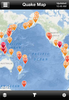
QuakeFeed 2.0 is live in the App Store! This version of QuakeFeed brings several improvements including:
Download QuakeFeed [iTunes Link] now and see why users have given it 4.5 stars and rave reviews!


QuakeFeed is featured in the April 2011 issue of ArcWatch, a monthly e-magazine published by Esri.
In the article, Understanding Japan's Earthquakes from a Geospatial Perspective, a number of informative maps and analyses are presented to gain a deeper understanding of the March 11 magnitude 9.0 earthquake off the coast of Japan.
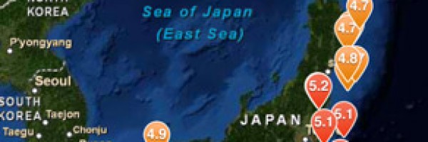
Spatial analysis is also increasingly possible on mobile devices. QuakeFeed is an app from Artisan Global that runs on iPhone. It allows the listing, mapping, and querying of current earthquakes anywhere in the world. This image shows epicenters of quakes in and around Japan according to data taken from a smartphone a week after the major earthquake struck.
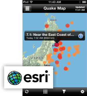
Created with ArcGIS for iOS, QuakeFeed displays all earthquakes from the past 7 days with a magnitude > 2.5 on a map or in list. Six different basemaps are provided, along with a variety of filter and sort options. The app is location aware so that you can find quakes that are closest to you. It has an intuitive user interface and features Twitter, Facebook, and email integration
Read More
The Property I.D. Easy NHD iPhone app enables real estate agents to order natural hazard disclosure reports while they are out in the field.
Read More
Artisan Global helped CitySourced integrate the ESRI ArcGIS API into the iPhone and Windows Phone 7 versions of their citizen engagement app.
Read More